Aerial Mapping

2D & 3D mapping, RTK / PPK flights & G.I.S. services

Aerial Drone Mapping

High-resolution data and deliverables

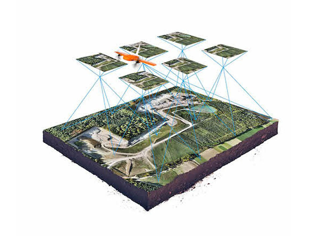
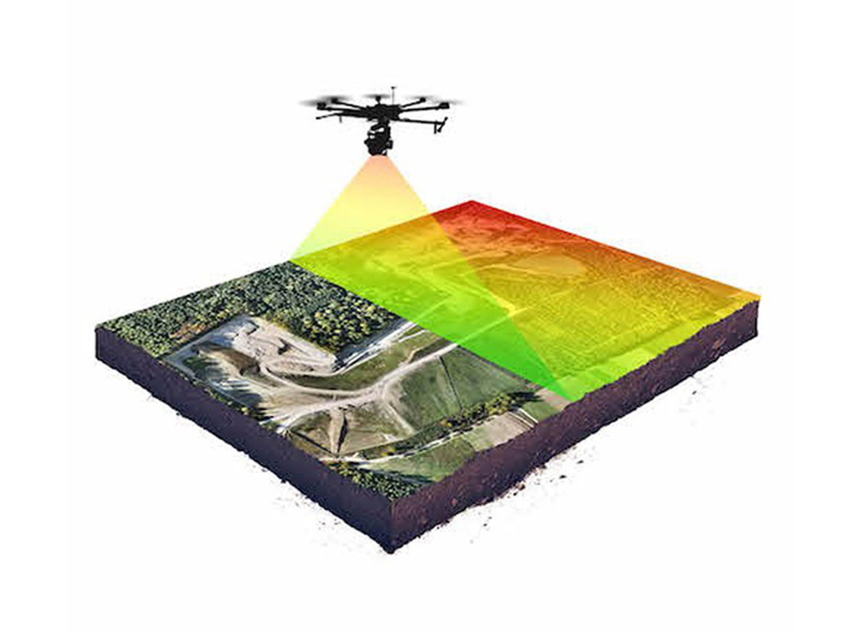
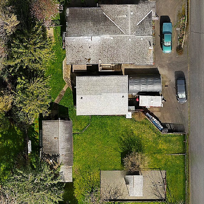
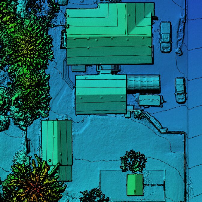
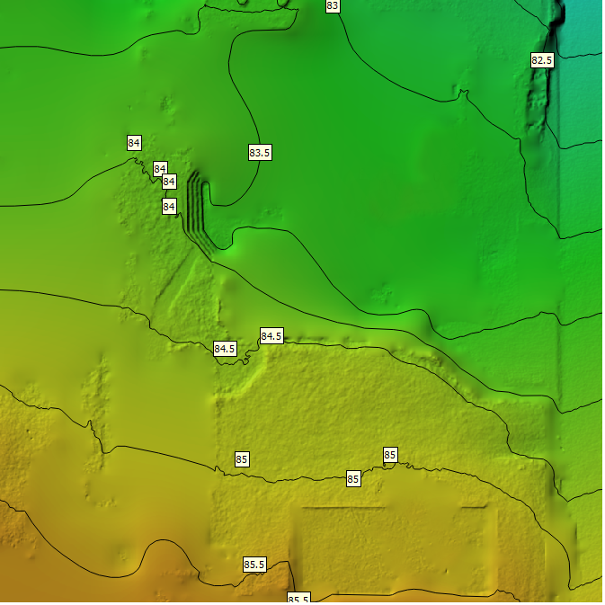
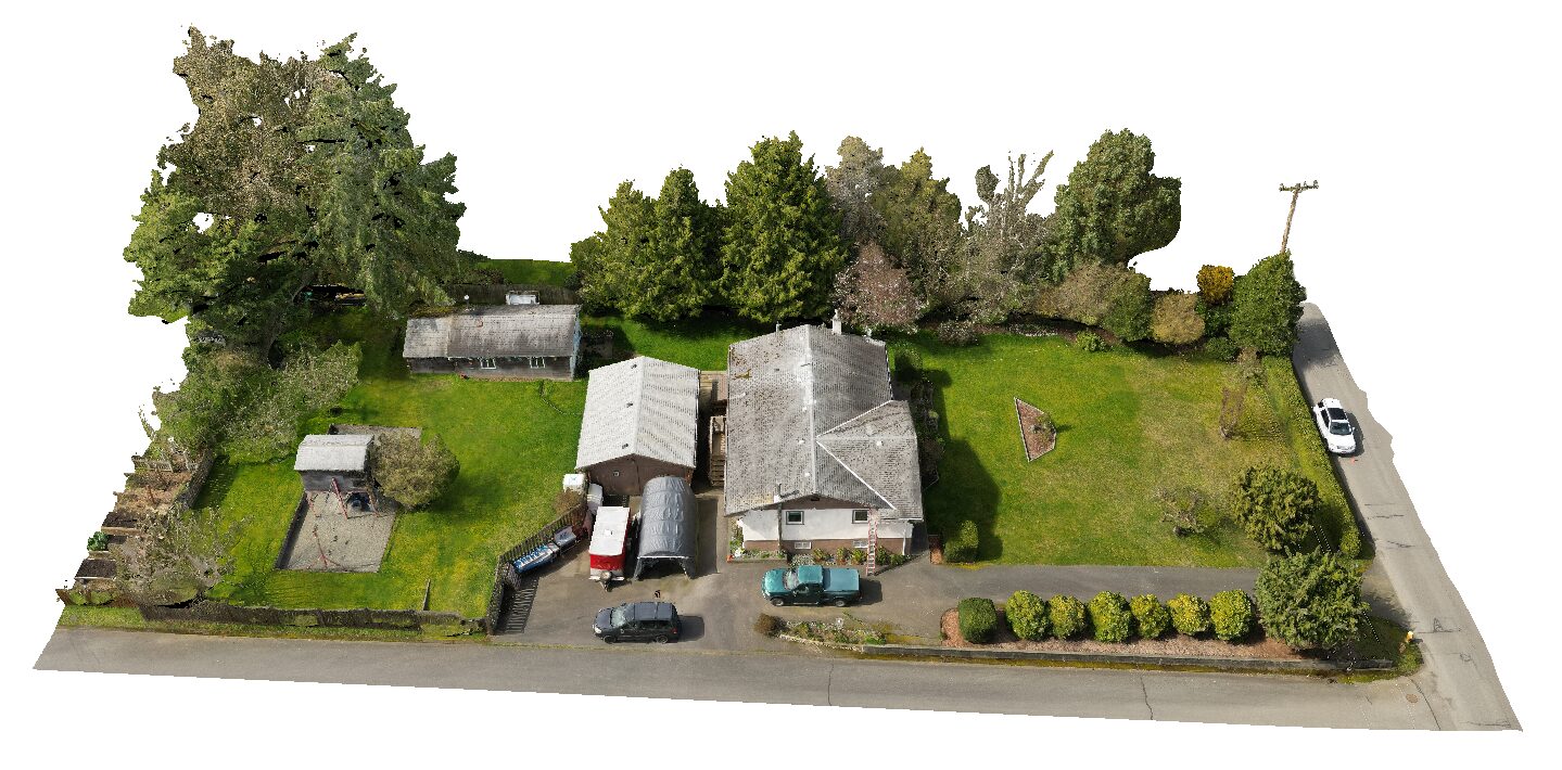
By programming our drones to fly automatic grid patterns overhead, we’re able to create photographic and topographic maps of project areas of up to hundreds of acres in size.

Our drone surveys produce high-resolution map imagery (typically at 2 cm resolution), digital elevation models and photo-wrapped 3D meshes.

CASE EXAMPLE

Somenos Marsh Outdoor Learning Centre

We’re proud to volunteer with the Somenos Marsh Wildlife Society, protectors of the creatures and natural habitat of S’amunu.

2D Map Imagery

Digital Elevation Model

3D Textured Mesh

Photo-textured 3D mesh of the Somenos Marsh Outdoor Learning Centre (Island Drone Services)

RTK & PPK Missions

Maximum data accuracy

For applications requiring centimeter-level positioning accuracy, we provide RTK (Real-Time Kinematics) and PPK (Post-Processed Kinematics) mapping flights with our DJI Mavic 3 Enterprise RTK and Phantom 4 RTK quadcopters, D-RTK2 base station and/or NTRIP wireless connectivity.

G.I.S. Services

Custom-made maps for all uses

We provide expert Geographic Information Services (G.I.S.) for all types of maps and data. We produce presentation-quality maps and digital materials and can provide high-resolution DEM tiles, imagery mosaics, geo-referencing or any other mapping requirements.

Get In Touch With Us

Whether you’re seeking dynamic aerial solutions or need assistance with drone projects, our team is ready to collaborate. Contact us today for professional guidance and personalized drone services tailored to your needs.